
The Yardage Book · phone PDF
Two pages per hole. The hole, then the green.
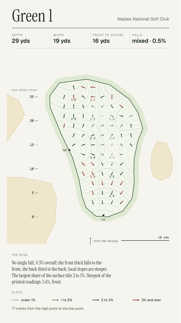
Line of play from the farthest tee. Yards to reach and carry every bunker and pond. The green drawn with its falls, one arrow every two yards.
Inside
What a hole page tells you.
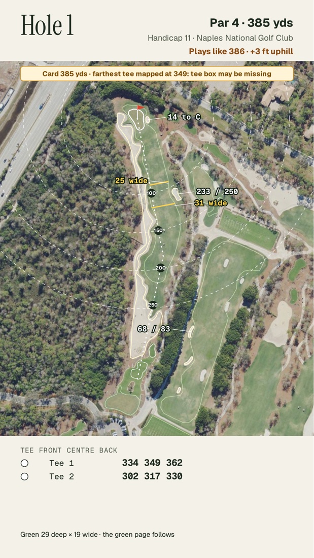
- 1The line of play From the farthest tee to the center of the green, with the yards left at each marker.
- 2Reach and carry Next to a bunker or water: yards from the farthest tee to reach it, then to carry it. Water beside the hole: where it starts.
- 3Fairway width At the distance that matters from the back tee.
- 4The tee table Front, center and back of the green from every tee box the map shows.
- 5Plays like Card yards plus one yard for every yard of climb, minus for a drop. No wind.
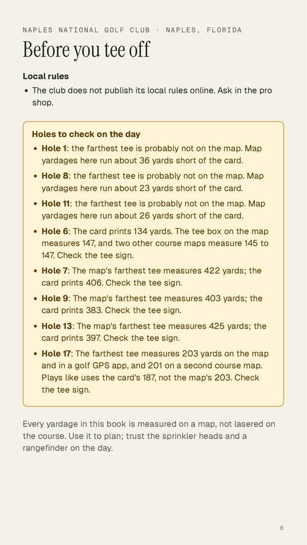
- 6The yellow box When the map and the card disagree on a hole's length, the page says so. Check the tee sign.
- ▼Arrows point downhill One every two yards, with the slope in percent every four. The ink darkens as the slope grows. Red means three percent or more.
- ▲High and low The highest and lowest points of the putting surface, with fine lines an inch apart between them.
- 0Yards from the front A scale down the side, to match the day's pin sheet.
- %The read Three lines in plain words: the overall fall, which third tilts most, and the steepest printed reading.
The front of the book
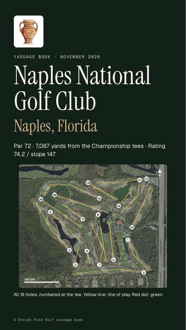
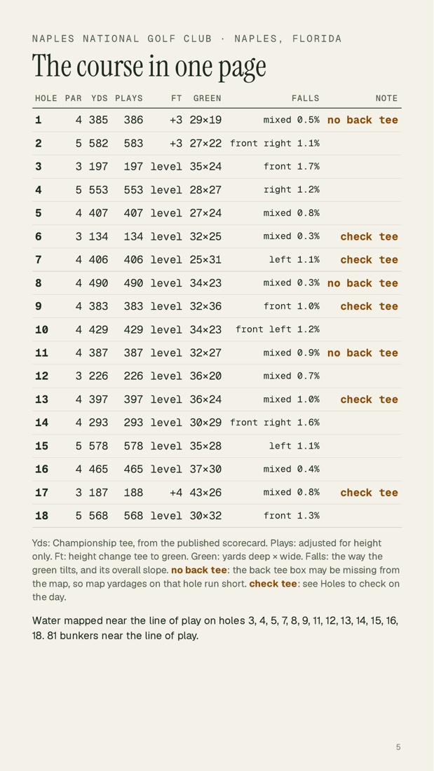
The course on one page.
Before the holes: the scorecard, every tee and rating, the whole course in one table, and the holes to check on the day.
The limits
What the maps cannot tell you.
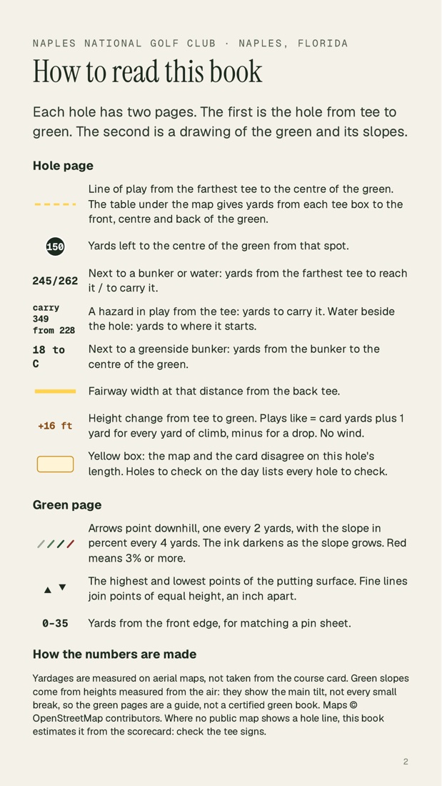
We measure yardages on aerial maps, not from the course card. Green slopes come from heights measured from the air. They show the main tilt, not every small break, so the green pages are a guide, not a certified green book.
Where no public map shows a hole line, the book estimates it from the scorecard and says so on the page. Check the tee signs. Maps © OpenStreetMap contributors.
| Format | PDF for a phone, 810 × 1440 points per page |
|---|---|
| Length | 43 pages for 18 holes: 6 front pages, 2 per hole, and a sources page |
| Built from | Public map data, lidar heights, aerial imagery, the club's card |
| Fonts | Instrument Serif, Geist and Geist Mono, the same as this site |
Request a kit
Tell us the club and the date you play.
We check the public map first. If a hole has no mapped line, we tell you before we build anything.
- 01Name the club and the town. Send the club's scorecard if you have it.
- 02We probe the map and reply with what we can build and what we cannot.
- 03The book and the kit arrive as PDFs: one for your phone, one for print.
- 04After the round, send the clips. The reel comes back as stills first, then video.